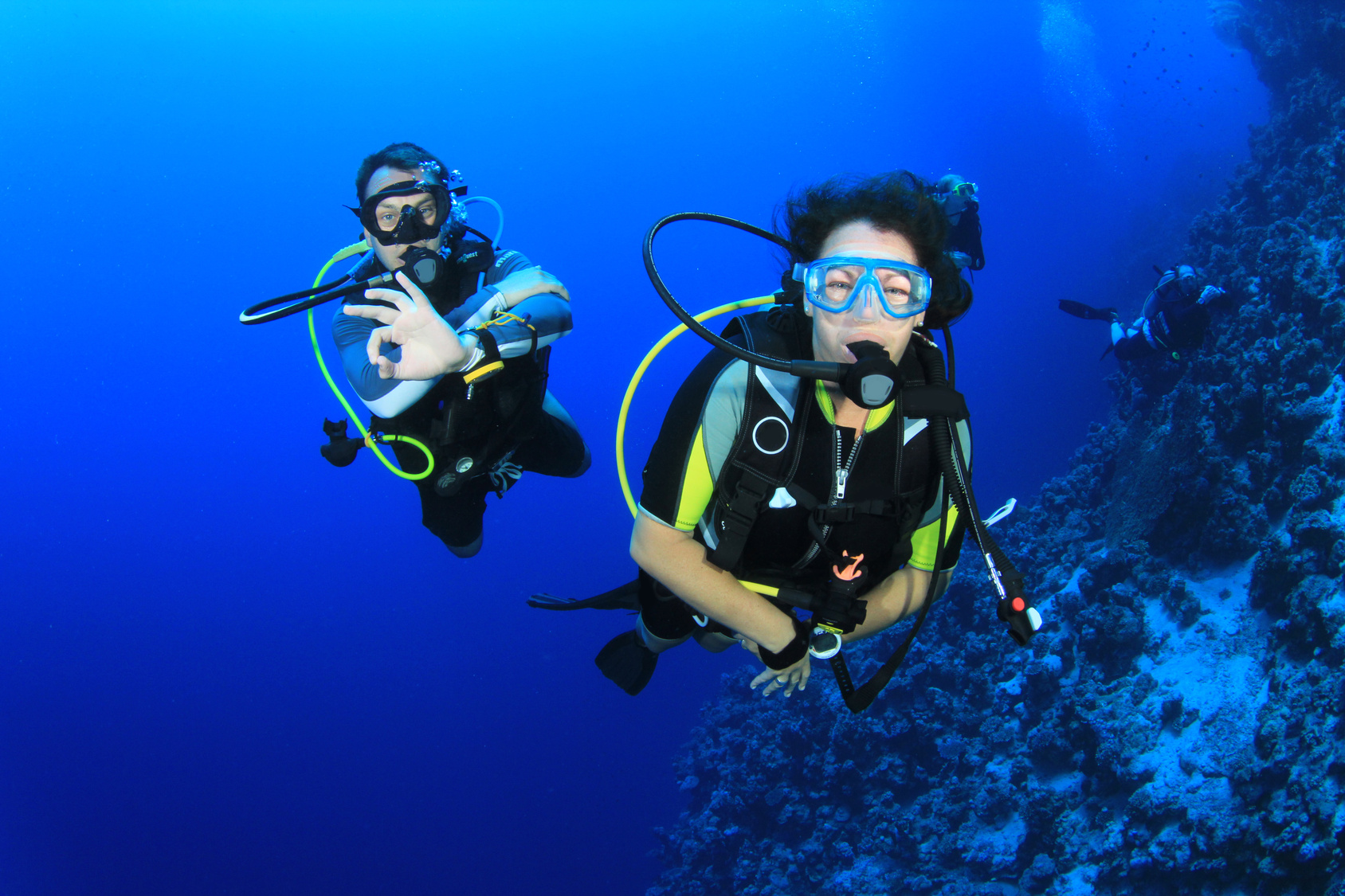
Marine Protected Areas (MPA), Sanctuaries, and Forest Reserves
Pohnpei Island currently has thirteen marine protected areas, including three mangrove forest reserves and two stingray sanctuaries. Additionally, Pakin Atoll has five of its own MPAs and all of Ahnd Atoll is a UNESCO Biosphere Reserve.
If you wish to visit a MPA it is best to work with a tour operators as they have the necessary permits that allow entry into these MPAs and biosphere reserves.
Current MPAs
Sapwtik MPA
Sapwtik Marine Protected Area is a 0.83 km2 (0.32 mi2) area encompassing Sapwtik (island), portions of its fringing reef, and sections of the lagoon southwest and northeast of the island.
Dekehos (Mwahnd) MPA
Dekehos Marine Protected Area is a 4.60 km2 (1.78 mi2) area encompassing Mwahnd Passage (Kepidauen Mwahnd) and portions of the barrier reef north of the pass and to the south as far as the fringing reef of Mwahnd Peidak (island).
Dehpehk MPA
Dehpehk Marine Protected Area is a 2.12 km2 (0.82 mi2) area encompassing the eastern and northern coasts of Dehpehk (island) and adjacent fringing reefs.
Nanwap MPA
Nanwap Marine Protected Area is a 3.05 km2 (1.18 mi2) section of the barrier reef and adjacent lagoon areas north of the Madolenihmw Bay passage (Kepidauen Deleur).
Senipehn Mangrove Forest Reserve
Senipehn Mangrove Forest Reserve is a 1.30 km2 (0.5 mi2) area of mangrove forest surrounding Dauen Sapwalap in Madolenihmw.
Namwen Na Stingray Sanctuary
Namwen Na Stingray Sanctuary is a 0.71 km2 (0.27 mi2) area encompassing both shallow reef and deep water areas located north of Na (island) and south of Nahpali (island).
Namwen Nahnningi Stingray Sanctuary
Namwen Nahnningi Stingray Sanctuary is a 0.34 km2 (0.13 mi2) area encompassing four large reef pools and the adjacent reefs northwest of Nahnningi (island).
Nahtik MPA
Nahtik Marine Protected Area is a 0.75 km2 (0.29 mi2) area encompassing Nahtik (island) and all fringing reefs.
Enipein Mangrove Reserve
Enipein Mangrove Reserve is a 9.55 km2 (3.69 mi2) area of mangrove forest located in Enipein, Kitti.
Kehpara MPA
Kehpara Marine Protected Area is a 1.89 km2 (0.73 mi2) area encompassing the three Namwmwour barrier reef islands (including Kehpara) and large sections of the barrier reef both north, south, and east of the islands. This area is completely closed to diving and snorkeling from January 1 to June 30 every year.
Pwudoi Mangrove Sanctuary
Pwudoi Mangrove Sanctuary is a 1.39 km2 (0.52 mi2) area encompassing large sections of mangrove forest in Pwudoi, Kitti, as well as adjacent fringing reefs and portions of the lagoon.
Wahulap MPA
Wahulap Marine Protected Area on Pakin Atoll encompasses Nikahlap Island and all surrounding reefs.
Painpwel MPA
Painpwel Marine Protected Area on Pakin Atoll encompasses Painpwel Island, a number of tiny islands off the north coast where sea turtles nest, and all surrounding reefs.
Palikir MPA
Palikir Marine Protected Area is one of Pohnpei’s largest inner-lagoon sanctuaries. It stretches from the shore of Palikir all the way to Palikir Pass. It is also one of Pohnpei’s most successful MPA’s and in 2020 efforts were made expand the MPA’s borders.
Sapangin MPA
Sapangin Marine Protected Area on Pakin Atoll encompasses Sapangin Island, several tiny islets to the north where sea turtles nest, and all surrounding reefs.
Kehrot MPA
Kehrot Marine Protected Area on Pakin Atoll encompasses Kehrot Island, many tiny islets to the northeast where sea turtles nest, and all surrounding reefs.
Mwahnid MPA
Mwahnid Marine Protected Area on Pakin Atoll encompasses Mwahnid Island and all surrounding reefs.
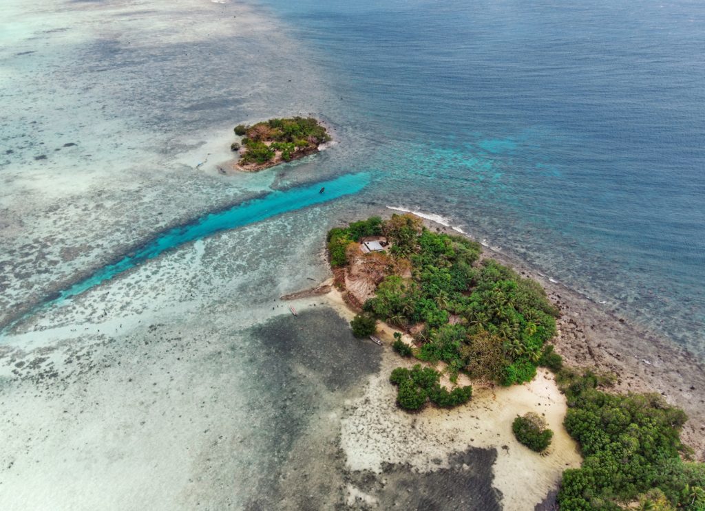
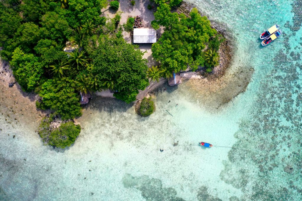
Nahnningi is known by most as “Joy Island”. There used to be a popular camping operation there in the 1990s, but for many years the island was not open to tourists. Recently it has become available again, but even more developed and open for both locals and tourists. The island is now called Para Nuii and is home to one of Pohnpei’s best picnic spots. The appeal of the island has to do with the shallow sandy areas around it, which are great for swimming and stingray-watching (beaches form at low tide) as well as housing situation. Para Nuii has fully furnished bungalows that stretch our from the northern end of the island. It is definitely “higher class” than most housing situations on the other islands, however because of this it does come with a steeper price tag than the other lagoon islands. There’s good snorkeling and SCUBA diving to the northeast along the outer reef and at a small channel near Mall. The Namwen Nahnningi Stingray Sanctuary is also within a close distance of the island.
Most archaeologists agree that Nahnningi is man-made and was constructed during the Nan Madol Period (it’s square and has low columnar basalt walls around much of its coastline). Purchase the Temwen Vicinity Eco-Adventure Map Guide for detailed maps and additional info.
To book a reservation for Para Nuii contact One World Plaza’s office located on the 1st floor of One World Plaza building or via their website listed below.
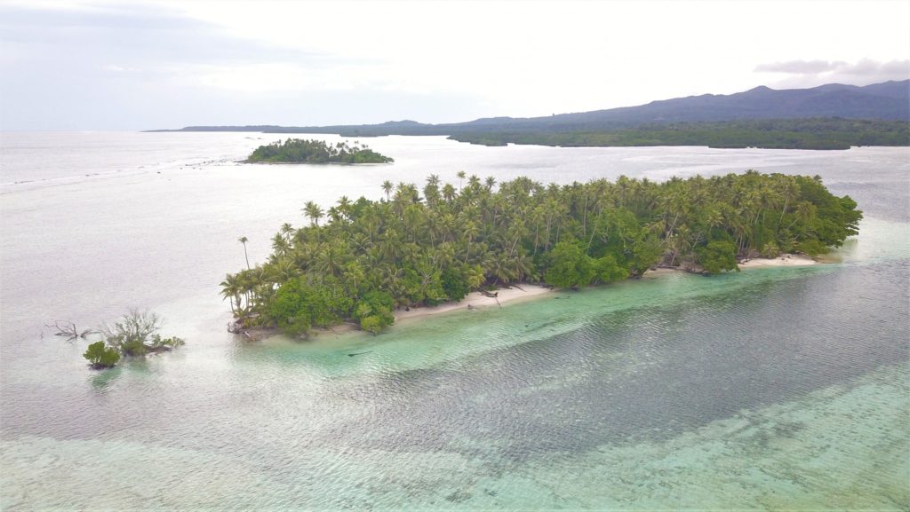
Ros is another beautiful uninhabited reef island in the south. The long, skinny island seems to be slowly disappearing as it erodes, but there are huge areas of wonderful sand on the west side to lounge about on and a narrow belt of trees. It’s mostly notable as a destination for paddlers, taking a break from exploring mangrove forests nearby, or SCUBA enthusiasts, resting between dives (Kepidauen Ros is one of two locations on Pohnpei famous for manta rays). There is good swimming and snorkeling a few kicks from the island.
For permission to visit or camp on the island, call +691.320.5896 or the Kitti Municipal Government Office at +691.320.5038, 320.5808, 320.5049, or 320.3257.
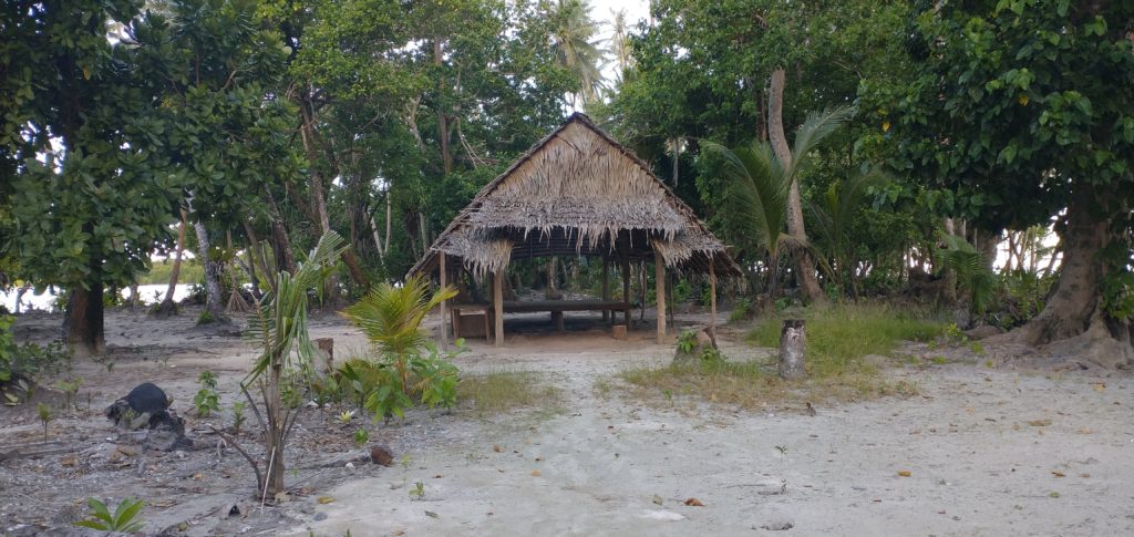
Nahlap remains one of Pohnpei’s most accessible and popular lagoon getaways, but visitors should be aware of the facilities and island conditions.
Many of the huts have basic amenities, but water access varies. Some huts, including the nahs (traditional meeting houses), currently have limited water systems. Toilets in the nahs are bucket-flush only, and there is no shower water available at those locations. Showers are available at some of the other huts, where water tanks are still functional. The larger green and blue huts appear to be the most maintained, with the blue hut offering the best bathroom facilities (still bucket-flush, but with a larger tank).
The boat service to Nahlap is typical of local lagoon transport — reliable enough but basic, without luxury features and not always the most comfortable ride. Travelers looking for a faster or more comfortable experience might consider working with a tour company or arranging a private charter.
Currently, major reinvestment in the property appears limited. However, Nahlap’s natural beauty still offers plenty for visitors to enjoy. The north end of the island, beyond the small church, feels particularly untouched and peaceful, with dense tropical plant life and mature trees providing shade and a true sense of isolation.
Key Points for Visitors:
• Bring extra drinking water and be prepared for limited freshwater availability.
• Facilities are basic: bucket-flush toilets, limited or no shower water in some huts.
• Boat transport is local-standard; tour companies or private charters may offer alternatives.
• Best suited for travelers seeking a rustic, nature-focused island experience.
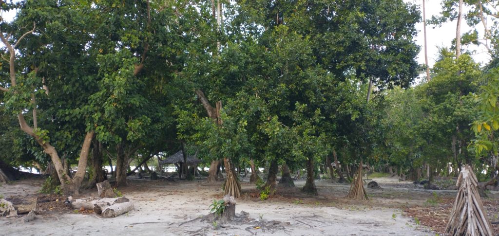
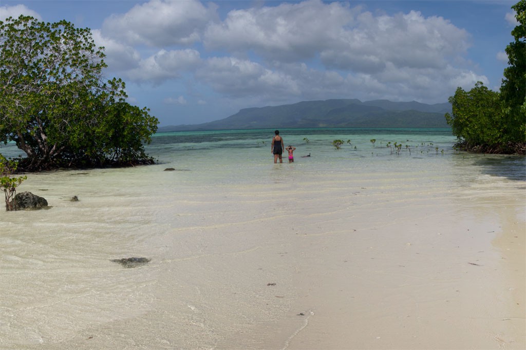
Dekehtik, which means “small island”, also called Sand Island is an uninhabited coral islet west of Na, of which it was once a part (not be confused with the island of the same name on which the airport is located). The north coast is most suitable for camping with some sandy beaches at low tide and stunningly clear water for swimming and ogling the many stingrays in the area. There are huts on the island for people to stay in while on the island. The island is currently owned by the Adams family (the proprietors of Ace Hardware and Ace Office Supply). The best snorkeling is northwest of the island along the edge of the deep, blue hole of Pahn Nahkapw. The island itself is characterized by thickets of shrubby vegetation and coconut palms. Sandy beaches form on the north coast at low tide.
To make reservations for day visits or night stays and to arrange boat transport call ACE at +691.320.8279 / 5637.
Dekehtik in the foreground, Na Island in the background (PC: Lee Arkhie Perez)
Deketihk Island with Nahkapw Island in the background. (PC: Lee Arkhie Perez)
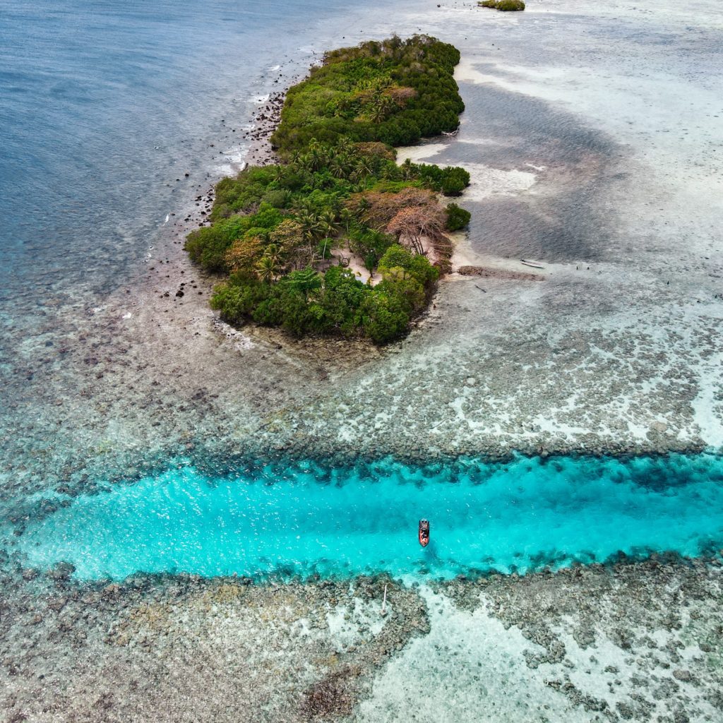
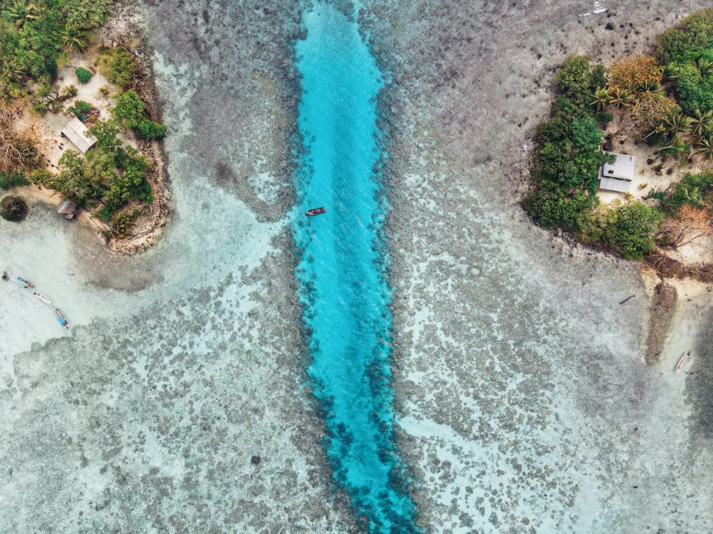
Though not as developed as Black Coral the small thatched huts are adequate for camping trips, the island is equally as shady and much larger than Black Coral, and it actually offers easier access to the excellent snorkeling around Kehpara Pass. It’s cheaper, too. At low tide, there’s a beautiful sandy beach between the two islands. The island has solar lights set up around the island to provide some light at night however we recommend bringing along a lantern and some flashlights to help illuminate inside the huts since they are not rigged with lights.
To make reservations for day visits or overnight stays and arrange for boat pick-up from the launch behind Seinwar Elementary School, call Nickson Abraham (Oaun Kitti) at +691.925.5340 / +691.920.8081 or the Kitti Municipal Government Office at +691.320.5038, 320.5808, 320.5049, or 320.3257.
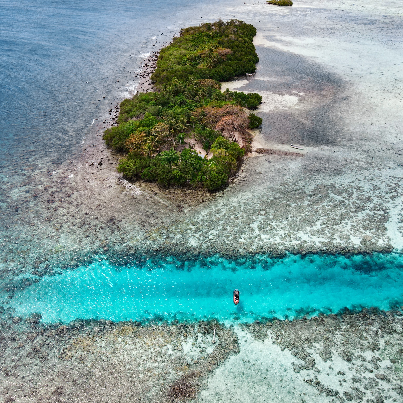
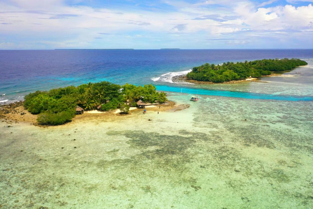
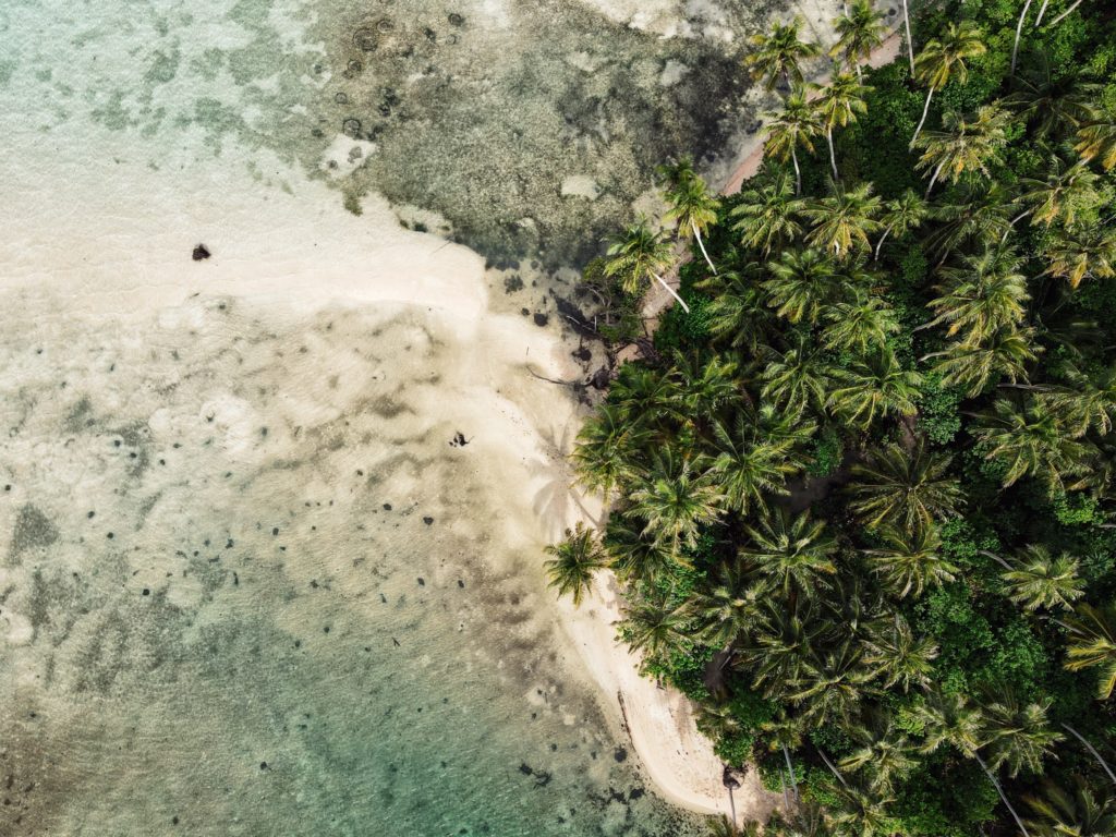
Black Coral (top island) and Kehpara (bottom island)
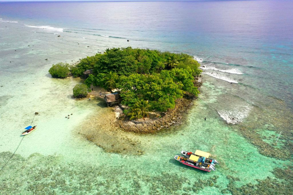
“Black Coral” is the southernmost islet in the Namwmour chain of islands that straddles Kehpara Pass (Dauen Kehpara) on the southwest corner of Pohnpei’s barrier reef. It’s true name is said to be Kehpara, but hardly anyone calls it that. Instead, Kehpara is usually used to refer to the island on the opposite side of the pass (island on lower right side of top image). In the mid-1600s, the conquering hero, Isokelekel, first entered Pohnpei’s barrier reef through Kehpara Pass on his way from Ahnd Atoll to Nan Madol. The sandy and well-shaded coral island, which lies within the Kehpara Marine Protected Area (MPA), is currently owned by the Adams family (the proprietors of Ace Hardware and Ace Office Supply). Black Coral is immaculately maintained with serpentine footpaths running here and there through large sprawling trees and several simple, wooden huts for overnight camping. Good snorkeling is located off the eastern shore and in the pass to the north, where white-tip and black-tip reef sharks, spotted eagle rays, and other marine wonders can often be seen. The best SCUBA diving is along the outer edge of the barrier reef north of the pass, a spot called Kehpara Wall. The area is a spawning ground for several varieties of protected grouper. Though some sandy areas appear at low tide along the inner coast, Black Coral doesn’t have any true beaches.
To make reservations for day visits or night stays and to arrange boat transport from the Seinwar Launch behind Seinwar Elementary School call ACE at +691.320.8279 / 5637.
PC: Lee Arkhie Perez
Black Coral from above. (PC: Lee Arkhie Perez)
Black coral on the left, Kehpara on the right. (PC: Lee Arkhie Perez)
Black Coral (top island) and Kehpara (bottom island)
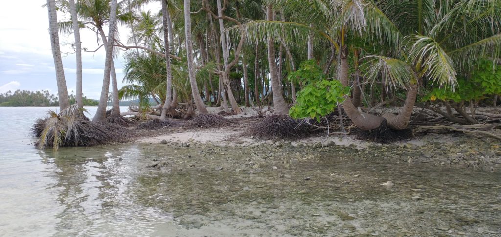
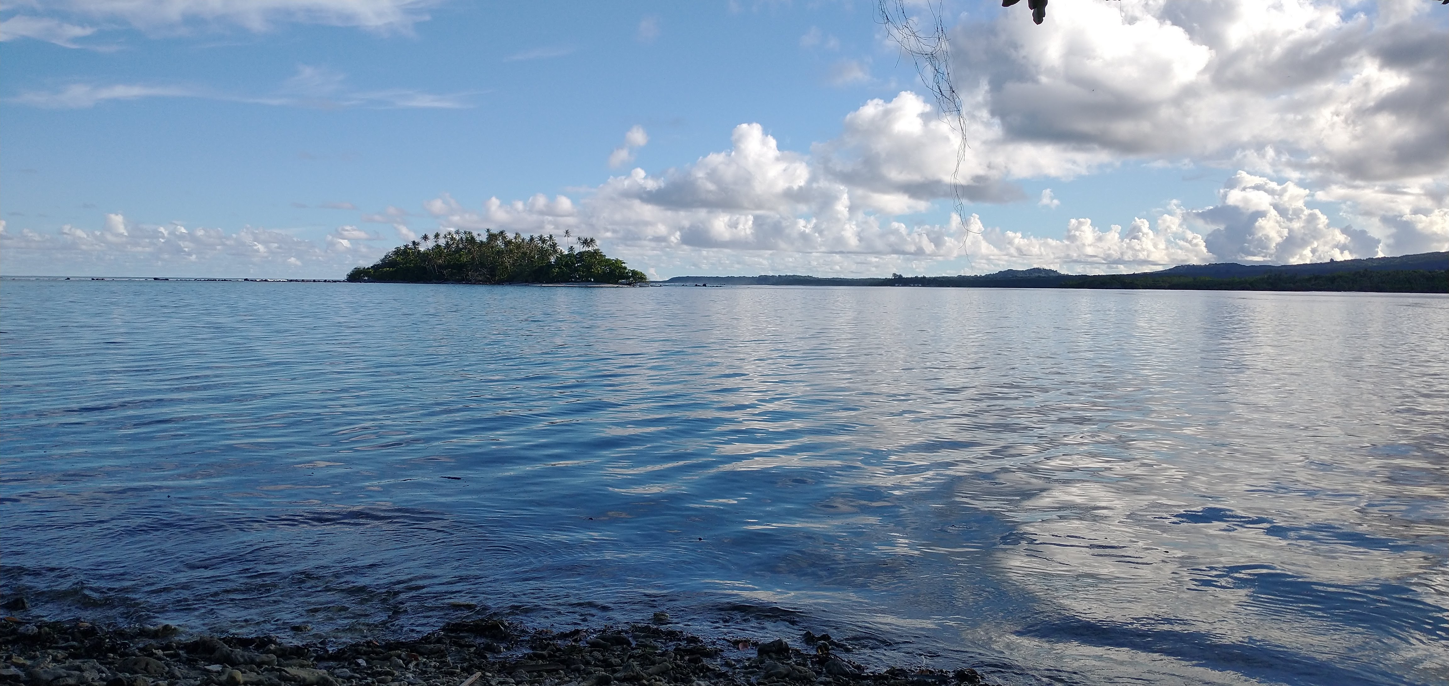
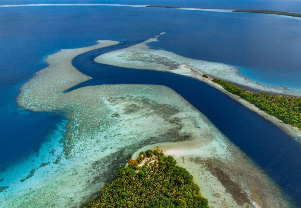
Beyond Pohnpei’s lagoon, the closest land to be found exists on two “satellite atolls” called Ahnd (pronounced änt) and Pakin (pä.keen). An atoll is made up of a number of coralline islets in a ring around a relatively shallow lagoon and is created when a high, volcanic island submerges over millions of years, leaving only the reef that fringed its shores. The islands form as sand, coral rubble, and other detritus collect on the reef and begin to support trees, small plants, and animals. Coral sand accumulates on the lagoon sides of the islands and creates beaches.
Ahnd (“Ant”) Atoll
Ahnd Atoll, popularly but erroneously spelled “Ant,” is 16 km (8 mi) southwest of Rohnkitti and consists of 13 low, luxuriant islands 3-4 meters above sea-level and a lagoon of 70 km2 entered by a single passage in the reef.
When the larger-than-life hero Isokelekel voyaged to Pohnpei, intent on overthrowing the rulers of Nan Madol, he came first to Ahnd and lived there for some time, learning about Pohnpeian customs from its inhabitants. In modern times, the entire atoll became the property of a single Pohnpeian family — the descendents of Henry Nanpei, who lived from 1862 to 1928. Nanpei’s shrewd business sense and knack for manipulating local power politics enabled him to acquire the atoll and amass a great deal of other land.
Ahnd Atoll Channel
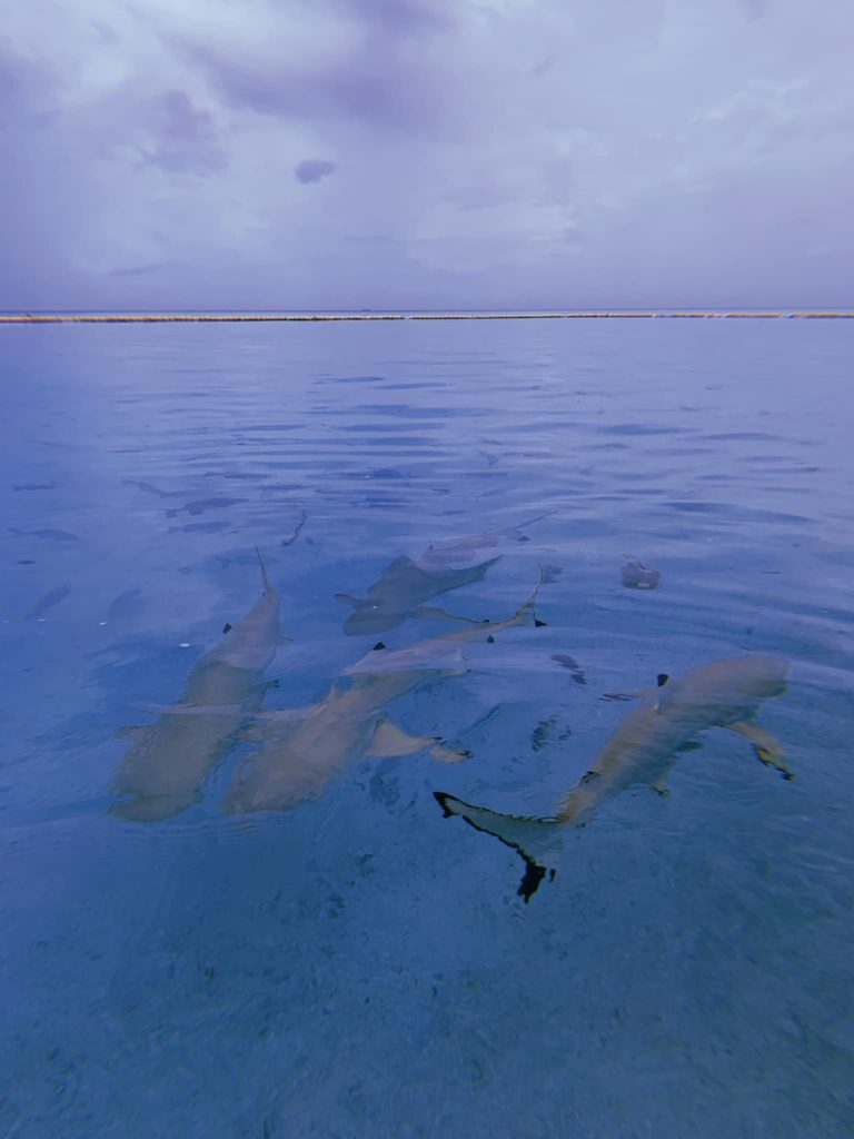
Black tip reef sharks at Ahnd Atoll (PC: Tia Panuelo)
Ahnd Atoll, Federated States of Micronesia (PC: Alex Zuccarelli)
Ahnd Atoll, Federated States of Micronesia (PC: Alex Zuccarelli)
Ahnd Atoll, Federated States of Micronesia (PC: Alex Zuccarelli)
Imwen Sapw Island and channel entrance
Today Ahnd has a few human residents, the biosphere rangers who make sure people do not fish within the protected area. There is also resort run by the Nanpei family located on the island of Pasa (information for booking trips can be found below).
It is home to some of the largest colonies of black noddies, terns, boobies, and frigatebirds in the Pacific as well as a healthy community of gray reef sharks in and around Dauenai (passage).
The most interesting islands to camp on are Pasa, Nikahlap, Dolen Mwuroi, and Nahlos. The former two have long stretches of deserted white-sand beach and excellent swimming. Nan Imwinsapw is closest to Dauenai (passage), where all the best snorkeling and the most accessible diving is found, but it has a big rat problem. Pahn Mwek is near to both excellent snorkeling and some of the rare diving that exists inside the lagoon. For the most part, however, the lagoon is the domain of snorkelers, sandy and punctuated by beautiful coral heads with lots of color and life at low tide.
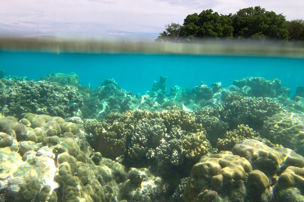
Dauenai on the south side is where most people go to SCUBA dive. It is known for orange sponges (on the west wall) and large numbers of barracudas, jacks, and sharks throughout. Reef fish populations around the pass, unfortunately, have declined in the last two decades, but hopefully will recover now that the area is protected. Even so, the place still feels busy compared to other locations and you’ll see all the familiar species — unicornfish, triggerfish, wrasses, surgeons, groupers, butterflyfish, angelfish, moorish idols, and more. Moray eels might be spotted on occasion. Spinner dolphins are regularly seen at the mouth of the passage and in the waters around Ahnd. Visibility in the pass, though not as spectacular as outside the reef, can reach 50 meters (164 feet) — certainly nothing to complain about.
In addition to drift-dives on either side of the deep passage, there is stunning (and frequently overlooked) diving on the outer wall of the barrier reef on the northwest side near Olouna (often known as “bird island” for the huge colonies of seabirds that nest there), and north of Pasa. The west wall of the barrier reef plummets to great depths, and because it is more protected from the northeasterly winds and waves, it is marked by an abundance of soft coral, holes, tunnels, and caves — an exciting place for any advanced diver. Giant clams are also common. Visibility on the outside edges can be extraordinary, exceeding 70 meters (230 feet). Currents can be swift both in the pass and around the outer walls.
Visiting Ahnd Atoll / Permission & Protected Areas
Because Ahnd is a privately owned island and UNESCO marine biosphere reserve permission is required from the Nanpei family for visits.
Contact LP Gas at +691.320.5661 / 2675 to make arrangements.
Core area(s) comprise a strictly protected ecosystem that contributes to the conservation of landscapes, ecosystems, species, and genetic variation.
A buffer zone surrounds or adjoins the core areas, and is used for activities compatible with sound ecological practices that can reinforce scientific research, monitoring, training, and education.
The transition area is the part of the reserve where the greatest activity is allowed, fostering economic and human development that is socio-culturally and ecologically sustainable.
Olouna (“Bird Island”)
Landing on Olouna island is prohibited to prevent disruption of the habitats of the seabirds who nest there. If you’d like to take a look at Olouna, consider making a kayak trip around it. You can arrange to pay your boat extra to transport a small ocean kayak or two.
Pakin Atoll
Pakin Atoll is composed of about 16 low islands, 13.6 km2 of reef, and a lagoon of 11 km2. It lies 38 km (24 mi) northwest of Palikir. In the early 1900s, Sokehs residents of Mortlockese descent were allowed to settle on the atoll, where their descendents (about 80) live to this day. Most of the islands are sparsely inhabited and all have excellent beaches, swimming, and nearby snorkeling.
One complication of visiting, however, is that Pakin has no true passage, making entry into the lagoon impossible for large boats and both difficult and dangerous for small boats. Boats enter at high tide at one of two places in the barrier reef (the usual spot is known as Uhrek), where the coral is slightly deeper than elsewhere — by a matter of a few inches. The crossing is narrow and complicated by strong surge. Except at the highest tides, the crossing must be carefully timed to correspond with the surge. Boats can easily capsize in the surf or be thrown up on the reef; several locals have been killed at the spot while trying to make the crossing in less than ideal conditions. When planning a visit, make sure that you hire an experienced pilot who knows this particular crossing and is committed to the safety of his passengers. Also, it is important to plan arrivals and departures to coincide with the highest tides.
All of the diving and the best snorkeling is on the reef wall outside the lagoon, where water clarity and reef conditions are simply mind-blowing. The wall north of Nikahlap is known for sharks, while the opposite side of the island is home to large schools barracuda. For sea turtle sightings, divers will want to try the walls on the northeast side. Turtles nest on many of the small islets north of Painpwel, Sapangin, Kehrot, and Osetik.
The world’s oceans are under siege, and Pohnpei — even as remote as it is — has not escaped the damage caused by thoughtless human activity. In addition to the increasingly dire effects of global climate change which are destroying coral reefs around the world, the most immediate threats to the island’s ocean environment include unsustainable fishing practices, piggeries and outhouses near water sources, coral dredging, garbage, mangrove forest destruction, and terrestrial deforestation (often as a result of sakau farming). The latter allows increased run-off and the fouling of inner reefs by sediment.
The good news is that there are many things you, as an individual and a visitor, can do to affect change:
Abstain from sportfishing
Despite what sportfishing operators will claim, sportfishing and fishing derbies DO impact the health of fish populations negatively. A single fisherman may not make much of a dent, but a couple hundred sport fishermen and a few derbies a year have a significant effect, eliminating some of the largest individuals of a particular species in the area. This is the primary reason that the Pohnpei Eco-Adventure Guides do not promote sportfishing operations on Pohnpei. Help to eliminate this damaging practice by abstaining from sportfishing entirely and avoiding fishing derbies.
Buy only local fish that comply with size and species regulations
Selling fish that are too young to have reached reproductive age is illegal on Pohnpei, but you still find undersized fish in local markets. Not only should you refuse to buy these immature fish, but you should report the market selling the fish to Conservation Society of Pohnpei. Immature fish on the chopping block mean that some fish never had an opportunity to breed and produce young before being killed. This directly reduces the size of fish populations, because those being caught are not being replaced. The success of fishing prohibitions around Pohnpei’s marine protected areas speaks for itself; if you stop killing the fish, they come back.
Pick up your garbage / Make Less
Our oceans are being destroyed by our waste. Pohnpei’s landfill is on reclaimed land immediately next to the ocean. In extreme high tides or storms, both of which are becoming more common as a result of global climate change, the edges of the landfill are inundated and the trash goes out into the ocean. Additionally, trash is dumped directly into the ocean at other locations around the island. But the majority of trash in the seas, comes from large industrial countries like the United States and is carried into the Pacific by currents. There is so much garbage in the ocean that there’s a permanent named patch called the Great Pacific Garbage Patch. This is an area where floating plastic garbage is concentrated by currents. This trash is ingested by fish, birds, turtles and other sea creatures — killing them. The first step in fighting the garbage problem is to make less garbage by being smarter about what you consume (REDUCE). The second step is to REUSE everything you possibly can for as long as you possibly can. The third step is to RECYCLE everything that can be. But this last one is last for a reason — if you aren’t doing the other two steps first, you’re part of the problem. Recycling is expensive, uses a lot of resources, and is inefficient — especially on a remote island — so it should be a last resort.
Avoid use of plastic bags / one-time use bottles and containers
Given the information in the last point, this should be self-explanatory. Get yourself some good Tupperwear and a couple of durable, long-lasting metal or heavy-duty plastic water bottles and use those exclusively for all drinking and food-storage for years (or decades) to come. Don’t buy plastic bags or any other plastic materials that are used once and then thrown away. Don’t use Styrofoam or plastic take-out containers — bring your reusable container when you go out. Don’t use disposable plastic straws or disposable cups — bring your own reusable metal or plastic straw and cup. If we all shun these products, the industry will stop producing them.
Take nothing from the marine environment
Divers are familiar with this rule. Everything that exists in the marine ecosystem is there for a reason and has a purpose. When we take shells, coral, seastars, or other things from the ocean, we’re disrupting the natural structure of the ecosystem and preventing it from working the way it should. Enjoy nature with your eyes, but leave it where it is to live as it was supposed to. Take only pictures, leave only bubbles.
Exercise care when diving, snorkeling, or paddling to avoid damage to the reefs
Coral is very fragile and grows near the surface. When paddling, be mindful of tides and depth. Make sure you aren’t hitting the reef with your paddle or the hull of your canoe or kayak. The same goes for snorkeling and diving. Practice good buoyancy control. Keep a reasonable distance from the reef itself and watch your fins — make sure you aren’t inadvertently kicking anything.
Follow all MPA rules
Visit the MPA page for rules and MPA locations. The rules are there, not to annoy you or restrict your fun, but to keep the natural resources in those areas safe and healthy for generations to come. If you don’t follow the rules, you’re contributing to the destruction of those resources, plain and simple.
Write letters to Pohnpei’s governor (Marcelo Peterson), lt. governor (Reed B. Oliver) and acting administrator of fisheries and aquaculture (Clay Hedson) expressing support for conservation measures and encouraging strict prohibitions against dredging, sand-mining, mangrove removal, upland sakau cultivation, and destructive fishing practices
Office of the Governor
Pohnpei State Government
Kolonia, Pohnpei 96941 FM
Tel: 691.320.2235
Fax: 691.320.2505
Help financially support Conservation Society of Pohnpei (www.serehd.org) and Nature Conservancy (www.nature.org)
Both of these organizations work very hard locally to protect the environment. Directly funding them helps them be successful.
Minimize your carbon footprint
Your carbon footprint is the amount of carbon dioxide and other carbon compounds emitted due to your the various processes and forms of consumption that make up your life. Carbon emissions related to human activity are the cause of global climate change. There’s a lot of misconception about what is most important in reducing your personal carbon footprint. Here are some of the key things to focus on:
Cut Your Meat Consumption
In the U.S., government stats on household CO2 footprints indicated that food was the biggest factor in a person’s carbon footprint. In short, what you eat matters because of the way the things you eat are produced. Lifestock is responsible for 18% of all greenhouse emissions worldwide (in the form of methane) — more than the worldwide transport network (which is about 14%). If you eat a lot of meat in your diet, you are contributing to the growth of the meat industry and supporting the negative effects on the environment of all those animals being raised for your table. That doesn’t mean you have to become a vegan, but you can greatly reduce your personal carbon footprint by cutting down significantly on your meat intake. Large mammals produce the most emissions — particularly cattle. One kilo of beef does as much damage to the environment as driving your car 160 miles. So make beef a once-in-awhile thing. When you do eat it, make sure it’s from grass-fed, free-range cows, which produce less emissions than feedlot cattle. Cheap beef is the worst; avoid it.
Avoid Produce Waste
Vegetarians have as much to worry about as dedicated carnivores. Emissions from produce decomposition accounts for a big part of those numbers in the previous paragraph. Large-scale farming and grocery operations are extremely wasteful and about a third of what’s grown is thrown away before even reaching the stores. Another third is thrown away at the store level when it doesn’t sell. That’s more than half of all the food grown. Small farm operations are generally less wasteful because they have more to lose financially by not getting everything to the consumer. Furthermore, transportation of produce is an issue. The further something has to travel to get to you, the more CO2 emissions are involved. That means doing your best to buy from small, local farms as much as possible and staying away from imported goods within reason. To avoid wasting produce you’ve bought, keep it stored properly and make a meal plan so it gets eaten before it spoils.
Cut Your Electricity Use at Home
Lights are actually not the area where we use the most electricity in our homes. It’s cooling and heating — and we need more of both if we have a poorly-insulated home. About a third of the energy used to heat and cool people’s homes is lost through the walls and roof. On Pohnpei, concrete homes make zero sense. They have no insulation at all. They heat up like an oven when it’s hot and soak up moisture the rest of the time. Wherever you live, you can reduce your carbon footprint a great deal by upgrading your house, making sure it’s well-insulated, has the right windows and doors, and utilizes natural airflow for cooling instead of air-conditioning.
Buy Less
The next thing on the list is consumption. Leisure goods and services account for more CO2 than private transport does. When you add in clothing, footwear and household goods, that makes up a third of our emissions from consumption. So, though riding your bike instead of driving is great, you’re forgetting a bigger problem if you don’t curb your buying habits as well. The more we buy, the more we’re contributing to all the processes surrounding those products: the manufacturing, the transportation, the packaging, and the waste when the product is thrown away. Consider the following example. You buy a new t-shirt from a big store. You’ve just added to your footprint the impacts of (1) the farm machinery where the textiles were grown, (2) the factory where the raw materials were processed, (3) the factory where it was made into clothing, (4) the surface transport that brought the product to the store, (5) the store that stocked and displayed the shirt, and (6) the vehicle used to travel back and forth from home to store. A lot of what we buy, we don’t need, and once you start realizing that and thinking carefully before buying, it’s easy to cut out a lot. Every time you decide not to buy something, you cut your footprint a little bit. If you really can’t live without something, try getting it used. Resale stores are becoming more and more common.
Spend More Time Outdoors
What does a person do indoors? Chances are, many people spend most of their indoor time doing things like watching TV, staring at a computer, and talking on or browsing their smartphone, etc. All of those activities are connected to the manufacture and consumption of the products needed to do them. So they tie into #4 above. If you spend your leisure time outdoors, hiking, paddling, swimming, etc., you need that other stuff less and you’ll be less inclined to stock your house with footprint-increasing products.
Cut Down on Your Flying
Why is this one listed before driving? Because commercial flying generally gives you a bigger carbon footprint than driving does. It is true that cars worldwide produce more CO2 than planes, but that’s because there are many, many more cars and they’re much cheaper to use than planes AND most of them are carrying just ONE person. All of that is bad and we need to fix it. But, the numbers don’t lie — when you fly somewhere, in most cases, you are personally responsible for more carbon output than if you drove. Jet fuel produces slightly more CO2 per gallon than automobile fuel, but the real difference is all the fuel that planes waste on the runway, heating and cooling their interiors, filtering the air inside the plane, landing and taking off, accelerating to the speed necessary to take to the air, and ascending to the cruising altitude. Longer flights, for this reason, are more efficient. Short commuter flights are the worst, because they waste the most. Also, another problem with flying is when carriers don’t fill their flights. The overall impact of that one flight is nearly the same regardless of how many people are on the flight, but your personal footprint goes up the more empty seats there are on the plane, because the impact gets divided among a smaller number of people.
Drive Less
About 14% of global emissions come from transportation, which includes flying, driving, shipping, etc. Cars, trucks, and trains account for the biggest chunk, because there are so many of all of these types of vehicles around the world and they’re cheap enough that most people can afford to use them. In some places, you just can’t get by without a car because public transportation is poor and things are far apart. But, it’s our job to do everything we can to drive less, and when we do drive, to drive more efficiently, use efficient vehicles, use fuel that creates less emissions, etc. Don’t buy the big truck or SUV. Get an efficient sedan instead, or a hybrid or electric car if you can afford it. Bike or walk whenever possible. Ride electric trolleys, light commuter trains, and subways whenever possible.
Read More
This one is surprisingly easy, fun, and impacting. Reading makes you smarter and more knowledgeable. We all know that, but it also keeps us away from the types of consumption activities that modern people are drawn to.
The following files contain all the packaged GPS data for each feature or attraction on the Marine Attractions guide.
Three file types are provided. KMZ and KML files are compatible with Google Earth. KML is compatible with Google Maps. GPX files can be imported into ArcGIS (a professional mapping application) and some hand-held GPS devices.
NOTE: All files are free to the public and can be used for any purpose without permission.
Coastline
These lines were drawn during the course of this project from existing aerial photography and satellite imagery.
Including all mangrove forests around Pohnpei Island and its lagoon islands; these lines were drawn during the course of this project from existing aerial photography and satellite imagery.
Locations where poor water quality or environmental contamination make them unsafe for swimming have not been included here. This includes all of the watercourses around Mand, Madolenihmw Municipality (with one exception) and almost everything in Sokehs Municipality. Locations are GPS-verified.
Marine Protected Areas, Mangrove Forest Reserves, and Sanctuaries
Shapes are approximations based on data and maps provided by Conservation Society of Pohnpei (CSP) and were not GPS-verified in the course of this project.
The following coordinates correspond with sites featured on the Marine Attractions Eco-Adventure Map Guide. It is our dream to eventually create a Pohnpei GPS app that could be uploaded to smartphones and other devices, but for now, these points of interest can be entered manually in a hand-held GPS device as needed.
NOTE: All GPS devices have a margin of error. That margin increases with interference — when there is a thick canopy of trees, during bad weather, or when mountains obstruct the satellite link.


")

")
")
")