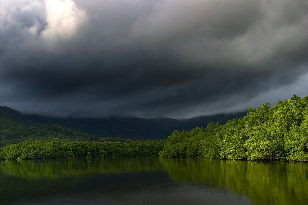
Dausokele Estuary
As paddling goes in the Nett region, Dausokele estuary (“channel of the dwarves”) is the crown jewel, a long, gorgeous inlet that lies between Kolonia and the leaf-shaped Nett Peninsula and serves as the mouth of a number of high-volume rivers and streams. The scenery is stunning, especially on days where rain threatens, with high, sheer cliffs to the east, the heights of Dolen Nett in the north, and the pyramid-like peak of Dolen Eirike in the south. Depending on where you begin, you can go as far as 4.5 km (2.8 miles) inland before having to turn around. Most of the way, mangrove forests skirt the coast, so there’s nowhere to land and get out. The final 0.7 km (0.4 mi) follows meandering, narrow natural channels through the swamp forests, where you’re liable to meet locals and traditional outrigger canoes and young kids having a swim. The route tends to be well-protected from both currents and wind, so it’s a nice, leisurely paddle, allowing plenty of time to soak up the scenery. There are multiple places to launch on the Airport Causeway as well as the “Ice Dock” near the Kolonia Public Market building, and next to the PAMI building.
Nett Point
Another great paddling destination is Nett Point, Kolonia’s best swimming spot and the closest thing to a beach Pohnpei Island has to offer. Lidakika Launch point on the Airport Causeway is the most practical place to begin.
- Visit the Nett Point page for detailed information about this location.
Dolen Nett Peninsula Circumnavigation
If you want to try something a little longer and more challenging, you can continue past Nett Point, explore the east coast of the peninsula (which includes one of the locations where the mythical builders of Nan Madol were said to have briefly settled), and then cross the beautiful little bay to the quaint picnic and swimming area at Awak Pah Marine Park. Note that strong winds can be a problem along the eastern coastal section. If you’re plan is a there-and-back-again, you’re looking at around 17 km (10.6 mi) round-trip.
Lenger & Sapwtik Islands
Two of the most interesting islands on Pohnpei are found directly north of Kolonia and can be reached quite easily via paddle-power. Both islands offer a wealth of Japanese fortifications from WWII and earlier, as well as other historical sites, swimming, and snorkeling.
- The islands are covered in detail on the Lenger Island & Sapwtik paddling page.
Parem Island
The largest island in the northern lagoon is Parem, which is large enough to have its own elementary school. Like nearby Lenger and Sapwtik, the Japanese fortified the island prior to WWII. In fact, the coastal gun on Sokehs Mountain may have once been positioned at the top of Dolen Parem before being moved to its present location.
With the exception of a portion of the eastern coast, Parem is completely surrounded by mangrove forests — some of them quite extensive. There are two good channels to explore on the west side where the mangroves are at their widest — one 0.7 km (0.4 mi) long and the other 0.4 km (0.25 mi). Both reach all the way to solid ground at high tide and are beautiful places to scope out the local birds. You can also do a complete circumnavigation of the island, which is 7.9 km (4.9 mi) in total. On the east coast there’s a long stone wharf jutting out from the shore, suitable for a little break, a snack and a dip.
Paddling Distances Around Nett, U & Northern Madolenihmw
| Starting | Ending | Distance (km) | Distance (mi) | |
| Lidakika Launch Point | —- | Causeway Tunnel | 1.5 km | 0.9 mi |
| Causeway Tunnel | —- | Dausokele Bridge | 2.4 km | 1.5 mi |
| Dausokele Bridge | —- | Inlet Terminus | 2.24 km | 1.4 mi |
| Causeway Tunnel | —- | Nett Point | 2.3 km | 1.4 mi |
| Nett Point, Nett | —- | Awak Pah Marine Park (along the coast) | 4.75 km | 3 mi |
| Nett Point, Nett | —- | Awak Pah Marine Park (as the crow flies) | 2.8 km | 1.7 mi |
| Lidakika Launch Point | —- | Awak Pah Marine Park | 17 km | 10.6 mi |
| Misko Beach, Dekehtik Island | —- | Barbosa’s Wharf, Lenger | 4.52 km | 2.8 mi |
| Ice Dock, Kolonia Town | —- | Barbosa’s Wharf, Lenger | 3.53 km | 2.2 mi |
| Nett Point, Nett | —- | Barbosa’s Wharf, Lenger | 1.97 km | 1.22 mi |
| Nett Point, Nett | —- | South Point, Parem | 2.5 km | 1.6 mi |
| South Point, Parem | —- | South Point, Parem (Loop) | 7.9 km | 4.9 mi |
*Silted-in reef. This segment may be difficult or impossible to traverse at low tide.


