Pahn Sile Waterfall

BikingHiking / TrekkingArchaeological Site / RuinWaterfallBird-WatchingCampingSwimmingPicnicking

Senipehn River pool, Pohnpei, Federated States of Micronesia (FSM)

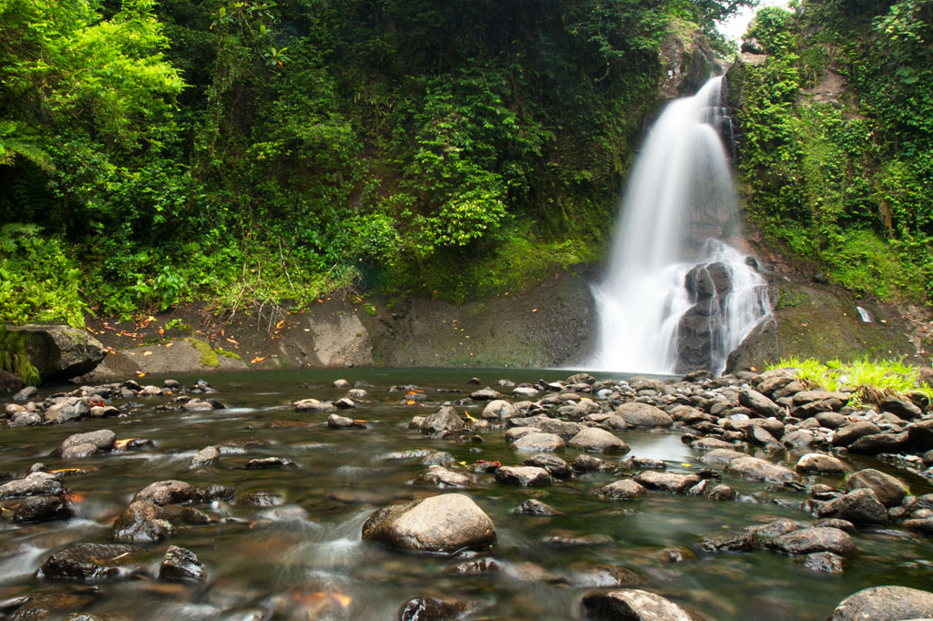
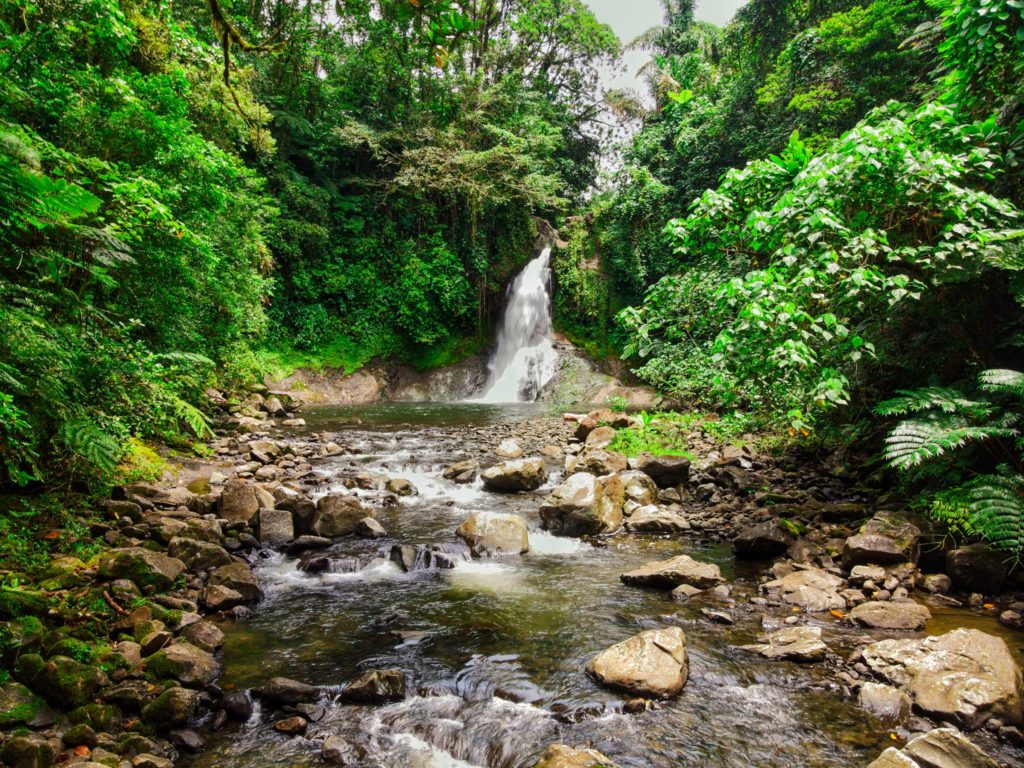
Located on the pristine Senipehn River, Pahn Sile is one of the few waterfalls well into the interior that almost anyone (even small children) can reach without the help of a guide — as long as you keep your eyes open for the branches in the path. A well-maintained trail begins at the end of the unpaved but well-graded coral and gravel road beyond Sapwalap Elementary School and opposite a concrete taxi stop. Houses are found along the path for much of the way, as well as historic rock-lined irrigation canals built by the Japanese. About 0.15 km (164 yd) before reaching the waterfall, a secondary path branches right and descends to a shallow point in the river, where you’ll cross and hug the right bank or walk in the stream as you continue to the falls just around the corner.

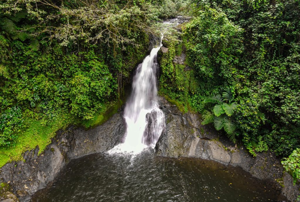
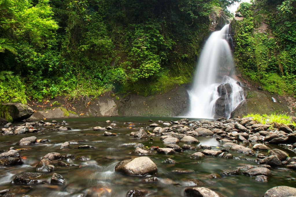
Pahn Sile Waterfall, Pohnpei, Federated States of Micronesia (FSM)

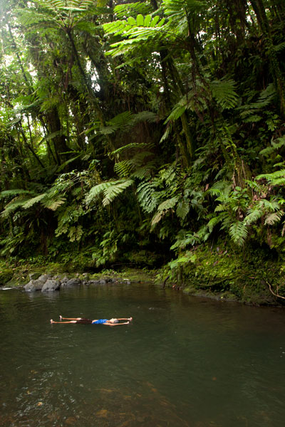
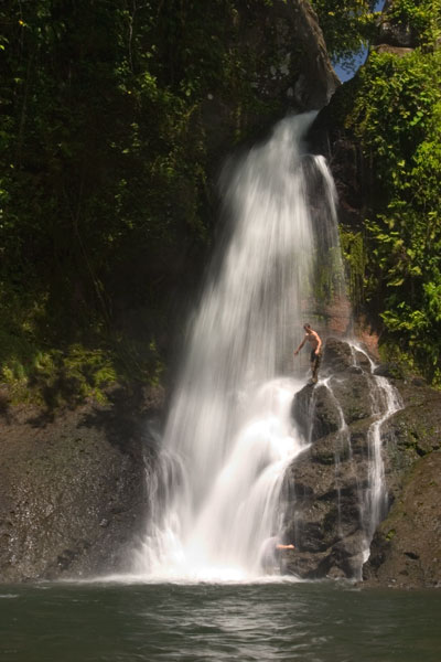
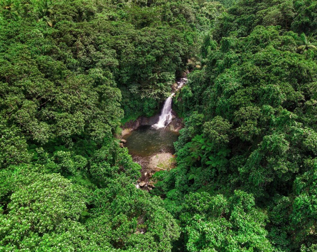
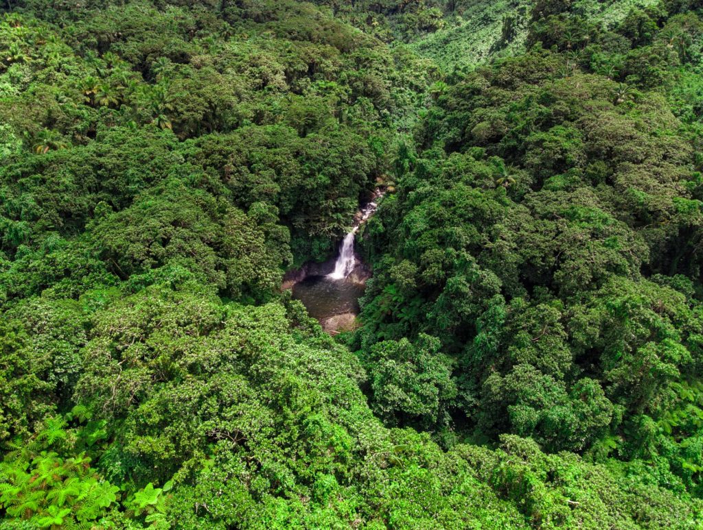
Pahn Sile‘s pool is wide and wonderfully cool, but not especially deep. The falls varies in volume depending on recent rain, gushing through a narrow portal and crashing onto rocks that form the rim of the pool. If you want a view from above the falls, bear left at the branch, proceed for 0.3 km (0.18 mi), and then cut off the trail and head straight toward the sound of the river. There is no path for this last part, but it’s easy enough to move through the forest. There are nice spots for a camp site above the falls in the forest along the path (pack out everything you packed in). In addition to the primary waterfall pool, there’s a small, deep pool just down river that is also an excellent place to swim, shaded by lush ferns and massive trees.

There are no access fees and no permission is needed to visit the falls.

If you would like a guide for the trip to the waterfall contact Raven at (+691)923-1862, he does not charge a fee but we do encourage you to tip him for his time.

  • Plan for 3 hours round-trip for this excursion.

Map Guides >> Central Madolenihmw >> Pahn Sile Waterfall

(Central) Madolenihmw GPS Data

Downloadable GPS Data Files

The following files contain all the packaged GPS data for each of the featured locations in the (Central) Madolenihmw Eco-Adventure Map Guide.

Three file types are provided. KMZ and KML files are compatible with Google Earth. KML is compatible with Google Maps. GPX files can be imported into ArcGIS (a professional mapping application) and some hand-held GPS devices.

NOTE: All files are free to the public and can be used for any purpose without permission.

Dolen Merewi Hike (2015)

Madolenihmw Bay Area Attractions (2015)

Nankep Waterfall Hike (2015)

Pahnsapw Waterfalls Hike (2015)

Pahn Sile Waterfall Hike (2015)

Pohnpaip Petroglyphs (2015)

Coordinates

The following coordinates correspond with sites featured on the (Central) Madolenihmw Eco-Adventure Map Guide. It is our dream to eventually create a Pohnpei GPS app that could be uploaded to smartphones and other devices, but for now, these points of interest can be entered manually in a hand-held GPS device as needed.

NOTE: All GPS devices have a margin of error. That margin increases with interference — when there is a thick canopy of trees, during bad weather, or when mountains obstruct the satellite link. The geosynchronous satellites employed when navigating on Pohnpei are located low on the southwestern horizon, such that maintaining a strong connection while hiking on the northeast side of a given mountain range can be difficult. Coordinates on the northeastern slopes of mountains are less accurate than in other locations.

Dolen Merewi

Dolen Merewi Turn-Off —- 6.882208° 158.290005°
Road Branching – bear left —- 6.881983° 158.278225°
Dolen Merewi Trailhead —- 6.880292° 158.274669°
Private Residence —- 6.880442° 158.274156°
Look-Out Point —- 6.883006° 158.270929°
Dolen Merewi True Summit —- 6.882815° 158.270869°

Madolenihmw Bay Area

Lukop, Metipw & Kepine Turn-Off —- 6.898141° 158.315994°
Road Branching – bear left for Lukop and Metipw; bear right for Kepine and Takaiuh —- 6.889728° 158.314120°
Bridge —- 6.884719° 158.313625°
Japanese Agricultural Plots —- 6.886711° 158.311515°
Nanpahlap Trailhead —- 6.876366° 158.318225°
Nanpahlap Summit —- 6.875491° 158.315744°
Tahio Trailhead —- 6.874010° 158.317018°
Japanese Dug-Out —- 6.873007° 158.316122°
Japanese Trench —- 6.872754° 158.315133°
Japanese Tunnel —- 6.873264° 158.314119°
Abandoned Community Hut (nahs) —- 6.872849° 158.314316°
Takaiuh Summit —- 6.872128° 158.310713°
Rocky Hill —- 6.874429° 158.308532°
Dauen Sapwalap Entrance —- 6.876938° 158.308196°
Japanese Rice Paddies Turn-Off —- 6.888314° 158.296764°
Japanese Rice Paddies & Irrigation Canals —- 6.887325° 158.303652°
Metipw Causeway / Launch —- 6.878051° 158.333074°
Mwudokolos Island —- 6.883576° 158.336525°
Dahu Reirei Island —- 6.888759° 158.344288°
“Channel Island” —- 6.899494° 158.342153°
Nanwap Marine Protected Area —- 6.872988° 158.353673°
Nahpali Island Dock —- 6.861877° 158.354457°
Salong Point, Temwen Island —- 6.856468° 158.322737°
MERIP Boathouse —- 6.844010° 158.308539°
Madolenihmw Ice Dock —- 6.849520° 158.302712°
Madolenihmw Bay Scenic Point —- 6.855273° 158.295686°

Nankep Waterfall

Nankep Waterfall Turn-Off —- 6.858738° 158.291440°
Bridge —- 6.858789° 158.291453°
Nankep Waterfall Trailhead —- 6.859867° 158.286390°
Nankep Waterfall —- 6.859335° 158.283177°

Nankepinmerepw Valley

Nankepinmerepw Turn-Off —- 6.873704° 158.286552°
Nankepinmerepw Trailhead —- 6.875185° 158.273305°
Senipehn Footbridge —- 6.876110° 158.271732°
Private Residence —- 6.877294° 158.263737°
Small Falls & Swimming Pool —- 6.877911° 158.242150°
Prismatic Basalt Quarry Site / Falls —- 6.878689° 158.240613°
Nankepinmerepw Waterfall —- 6.880498° 158.239370°
Block Waterfall —- 6.882766° 158.238850°
Trail Branching – bear right for Nahnalaud; bear left for “The Cave.” —- 6.888859° 158.288880°
“The Cave” —- 6.866427° 158.230917°
USGS Benchmark —- 6.874333° 158.230076°
Nahnalaud Look-Out Point #2 —- 6.874333° 158.230076°
Nahnalaud Look-Out Point #1 / Observed Summit —- 6.873876° 158.228524°
Nahnalaud True Summit —- 6.873323° 158.228724°
Nahnalaud Mountain Shelter —- 6.874001° 158.227374°

Pahnsapw Waterfalls

Pahnsapw Waterfall Turn-Off —- 6.871427° 158.285654°
Sakau Market —- 6.871839° 158.285500°
Sakau Market —- 6.871234° 158.285637°
Road Branching – bear right —- 6.870202° 158.282381°
Bridge —- 6.870052° 158.280071°
Road Branching – bear right —- 6.870060° 158.280108°
Road Branching – bear left —- 6.869425° 158.278666°
Pahnsapw Trailhead —- 6.868207° 158.278527°
Silbanuz Residence —- 6.867969° 158.278513°
Pahnsapw Lower Falls —- 6.865171° 158.277289°
Hidden Pool —- 6.865183° 158.277071°
Pahnsapw Upper Falls —- 6.864683° 158.277100°

Pahn Sile Waterfall

Pahn Sile Waterfall Turn-Off —- 6.873704° 158.286552°
Taxi Stop —- 6.873691° 158.286771°
Bridge —- 6.873629° 158.286431°
Road Branching – bear left —- 6.875588° 158.281340°
Road Branching – bear left —- 6.875802° 158.276411°
Road Branching – bear left —- 6.875179° 158.273294°
Pahn Sile Trailhead —- 6.873597° 158.269375°
Trail Branching – bear right —- 6.873598° 158.269382°
Trail Branching – bear left —- 6.873662° 158.269032°
Japanese Irrigation Canal —- 6.871403° 158.266674°
Japanese Irrigation Canal —- 6.870612° 158.265405°
Stream Crossing —- 6.866702° 158.264493°
Trail Branching – Bear right for waterfall & pool; left to see the falls from above —- 6.866048° 158.264342°
Senipehn River Crossing —- 6.865499° 158.263650°
Pahn Sile Waterfall Pool —- 6.864499° 158.263151°
Pahn Sile Waterfall —- 6.864467° 158.263028°
Break north From trail to see the falls from above —- 6.864209° 158.262860°

Pohnpaip Petroglyphs

Pohnpaip Petroglyphs Turn-Off —- 6.886941° 158.291017°
Bridge —- 6.886789° 158.290910°
Pohnpaip Trailhead —- 6.888161° 158.289097°
Herson Residence —- 6.887435° 158.288495°
Pohnpaip Outcropping —- 6.887621° 158.288259°
Magical Door of Pohnpaip —- 6.887551° 158.288181°
Takain Pahsu —- 6.888396° 158.288694°
“Hindquarters Rock” —- 6.888665° 158.288933°
“Enveloped Cross Rock” —- 6.888859° 158.288880°

Downloads >> GPS Central >> Madolenihmw GPS Data

Scroll to top